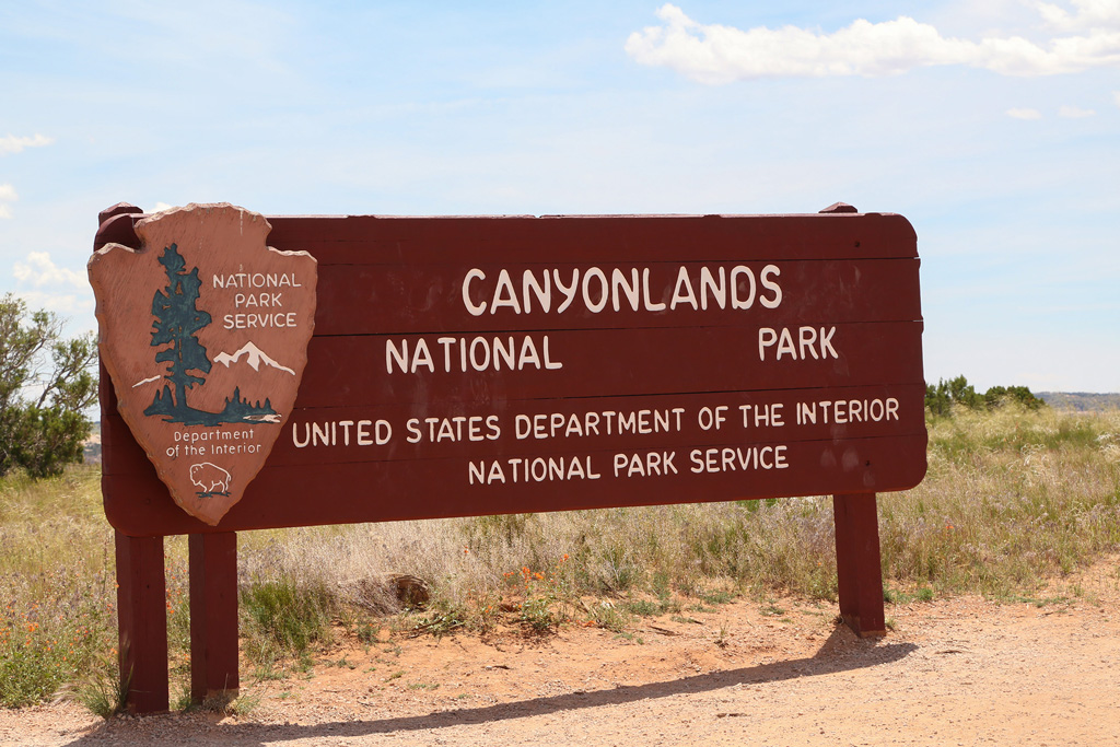
Canyonlands National Park
We left Moab early and headed north then west then south
and finally reached our destination.
Canyonlands is such a huge park, we had to pick just one area to visit, so we decided on Island in the Sky. I thought it was the most bang for the buck, which translates to we can see more is less time and with less hiking. We like hiking. It just takes more time and energy and we knew we would be limited on both.
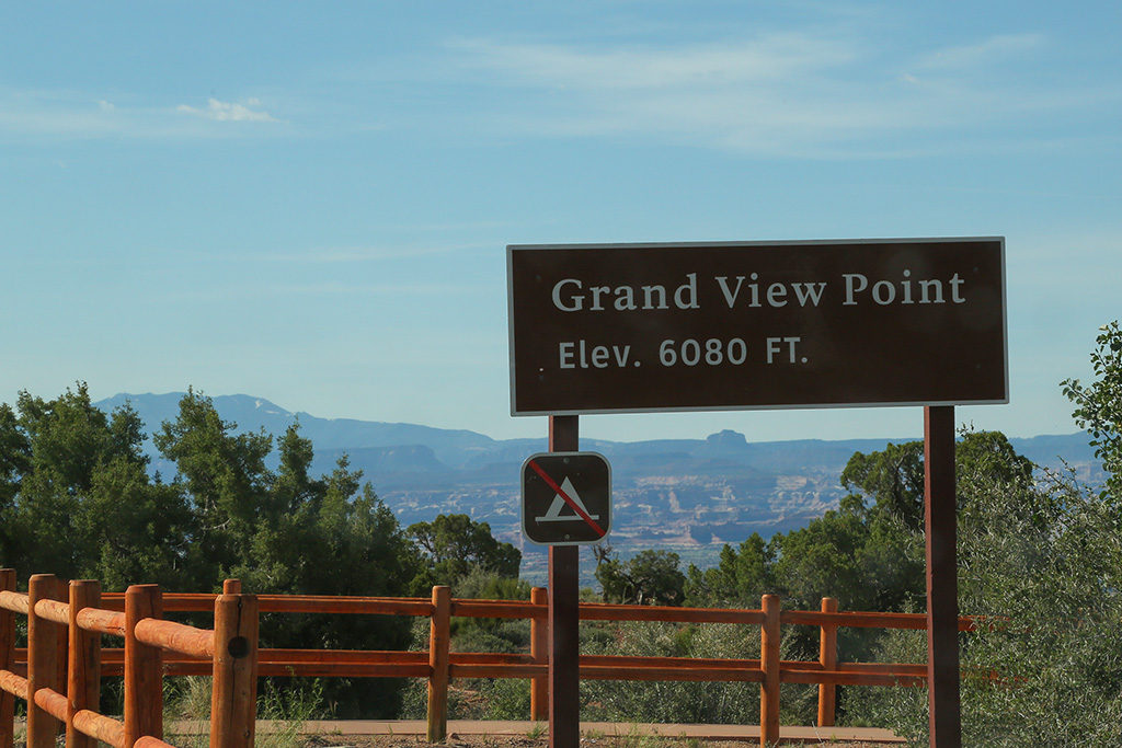
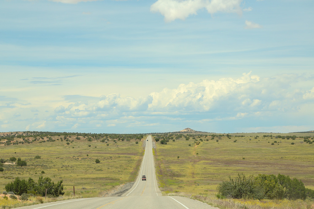
We drove all the way to the end of Grand View Point Road.
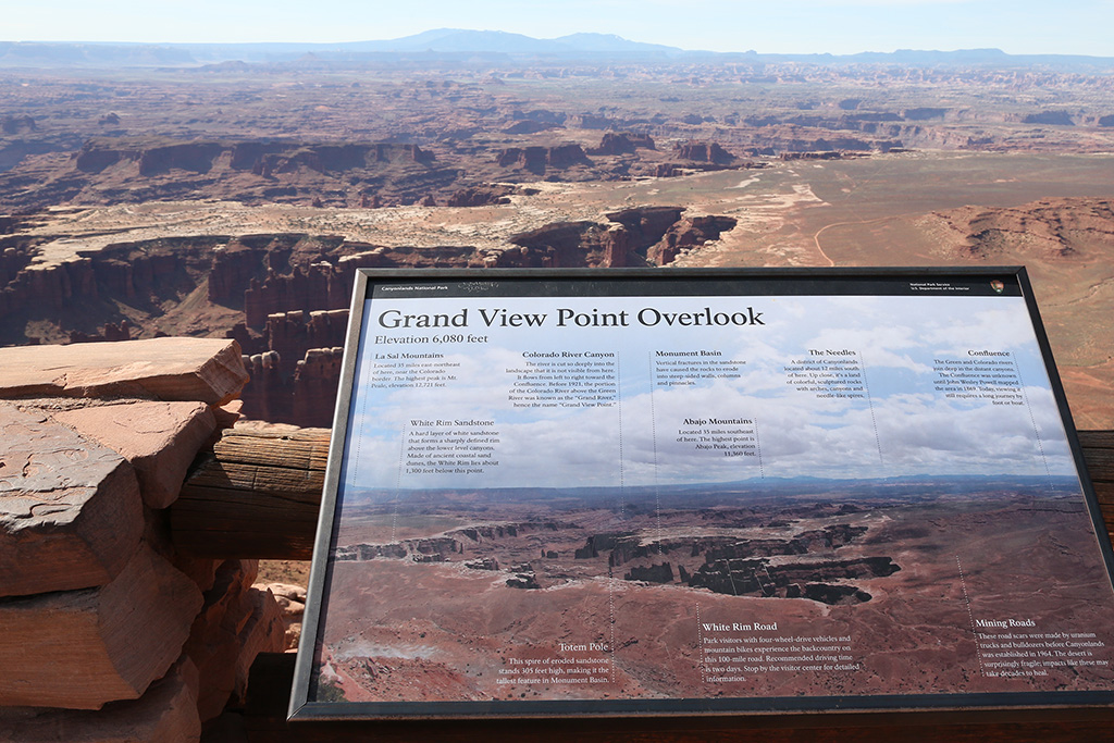
It was a long, mostly straight, flat drive with almost no traffic.
Let's zoom in.
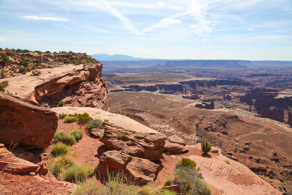
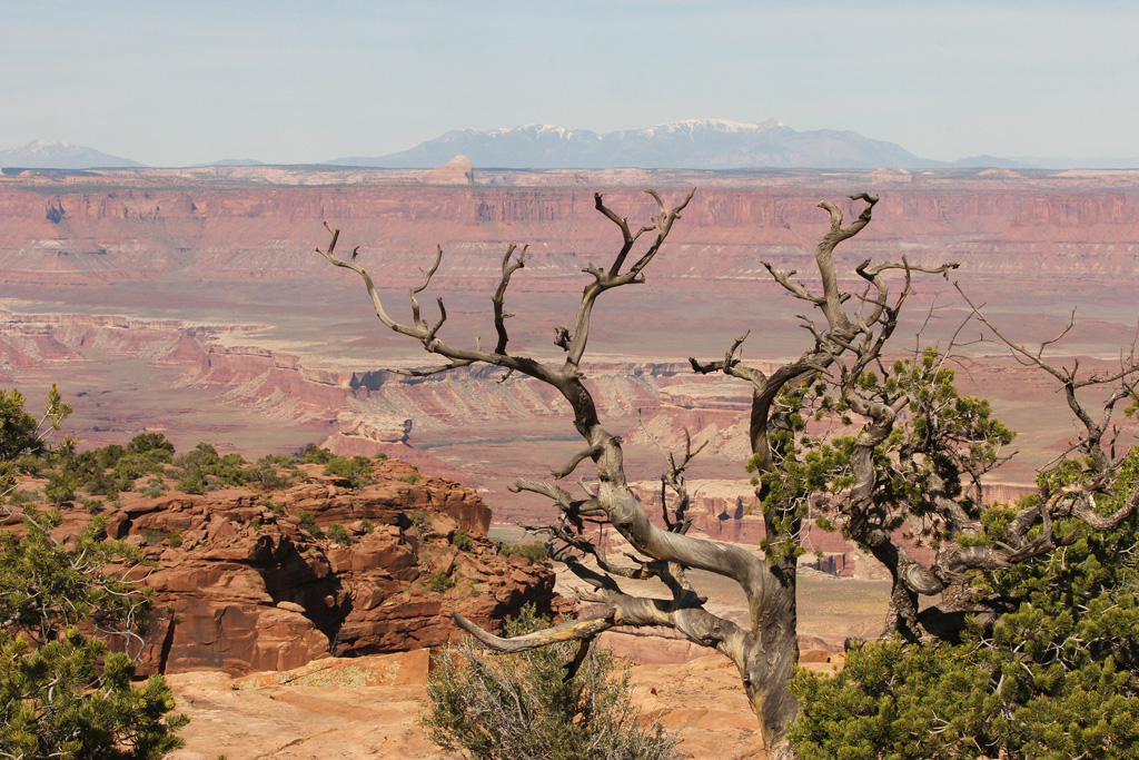
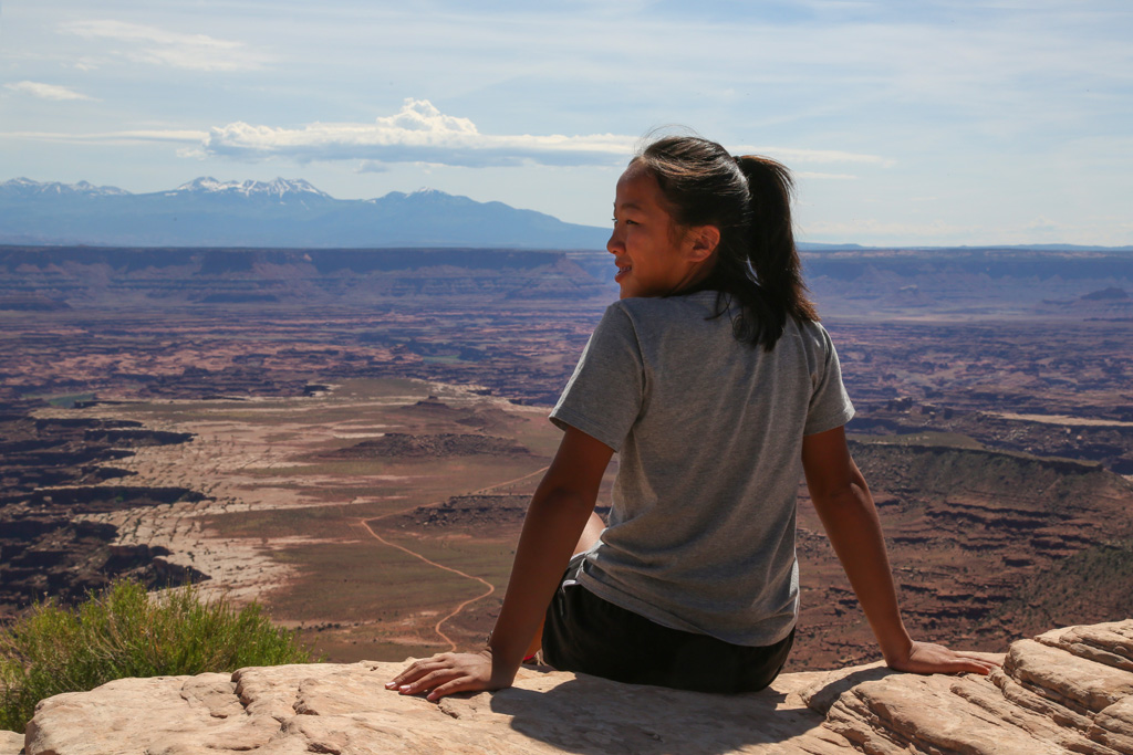
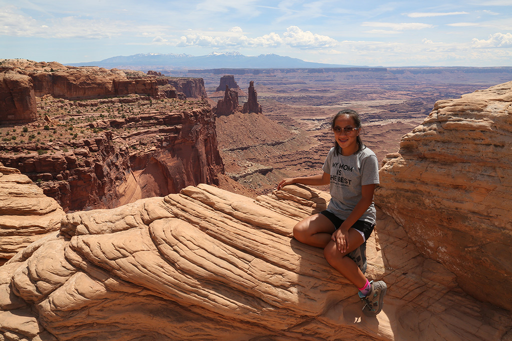
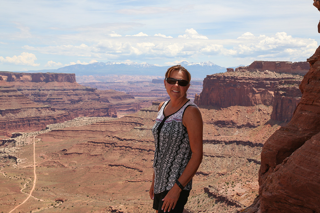
You can go right to the edge of the cliffs, but some of them drop off about 2000 feet so we stayed back several feet from the edge.
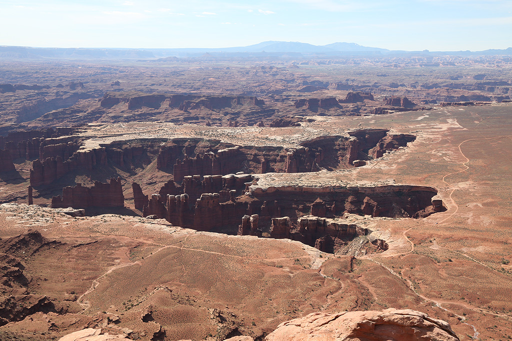
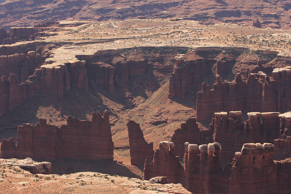
We thought Canyonlands should be called the Grand Canyon of Utah.
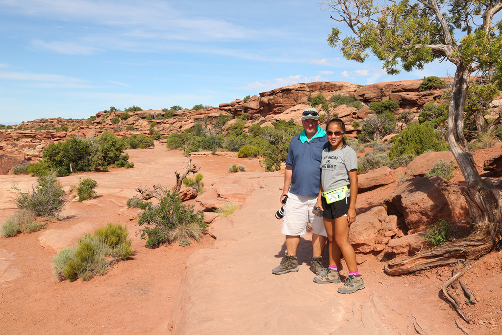
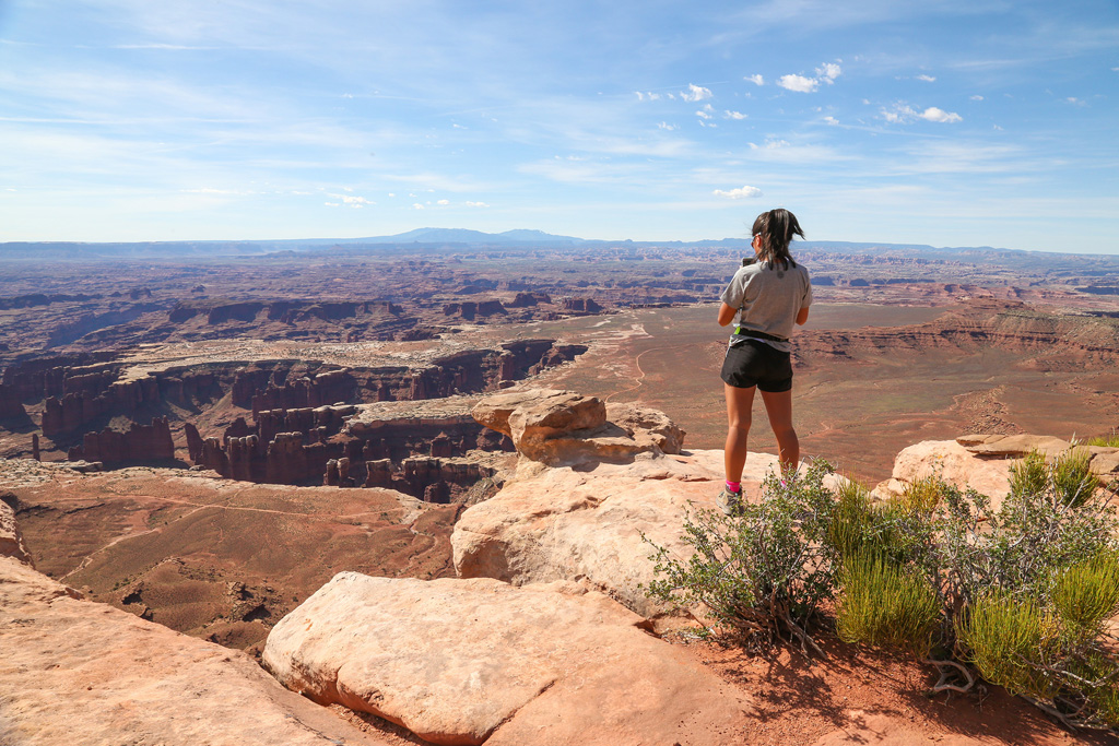
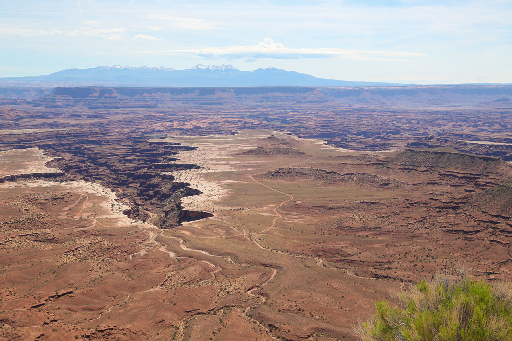
We did some hiking along the top rim looking down thousands of feet and out to the horizon miles and miles away.
It was already warm and sunny, which we like.
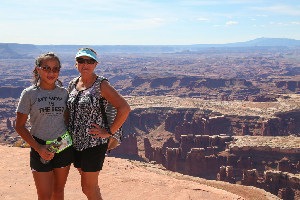
These views are to the south, southeast, and southwest. You can probably tell which are east by the lighting. It's morning.
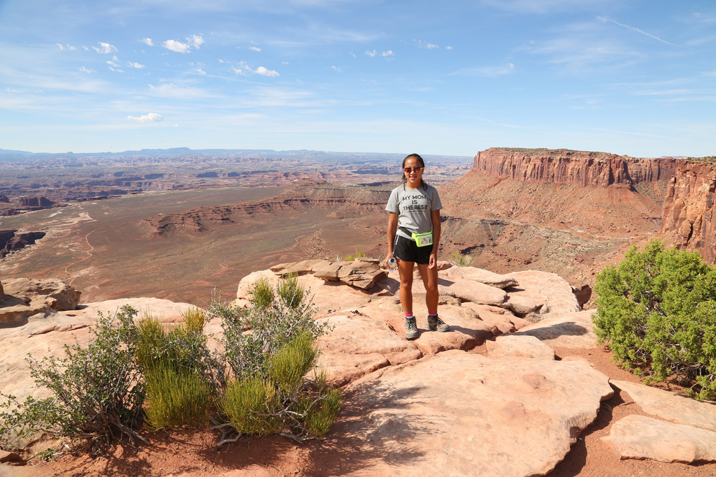
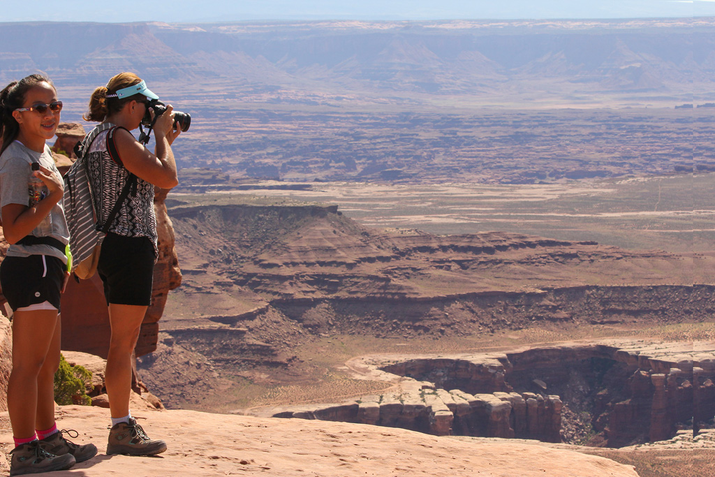
I like to include people in some of our images to show the massiveness of the area.
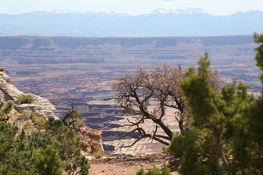
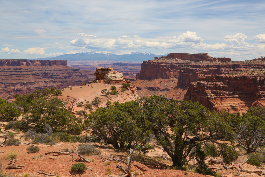
The Needles section of the park is in the distant east. We hoped to hike there but it is a very remote part of the park and we just couldn't fit it in during this trip.
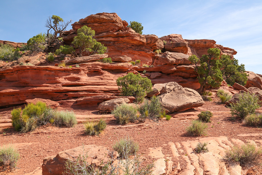
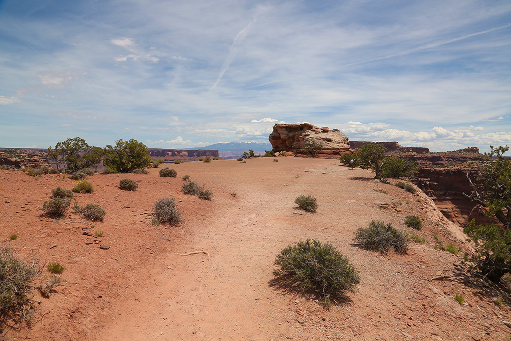
We enjoyed exploring the rocks and taking in the views.
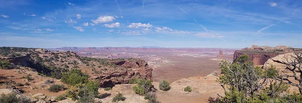
ORANGE CLIFFS OVERLOOK
We started heading back north, up the main road, where we noticed lots of stops for scenic overlooks, which means lots of pictures to us.
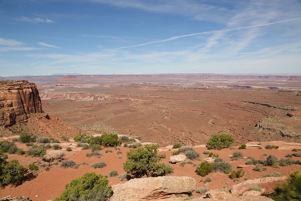
Looking west.
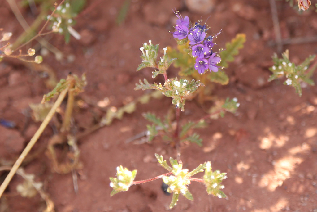
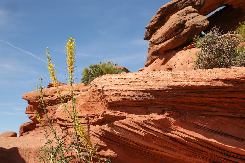
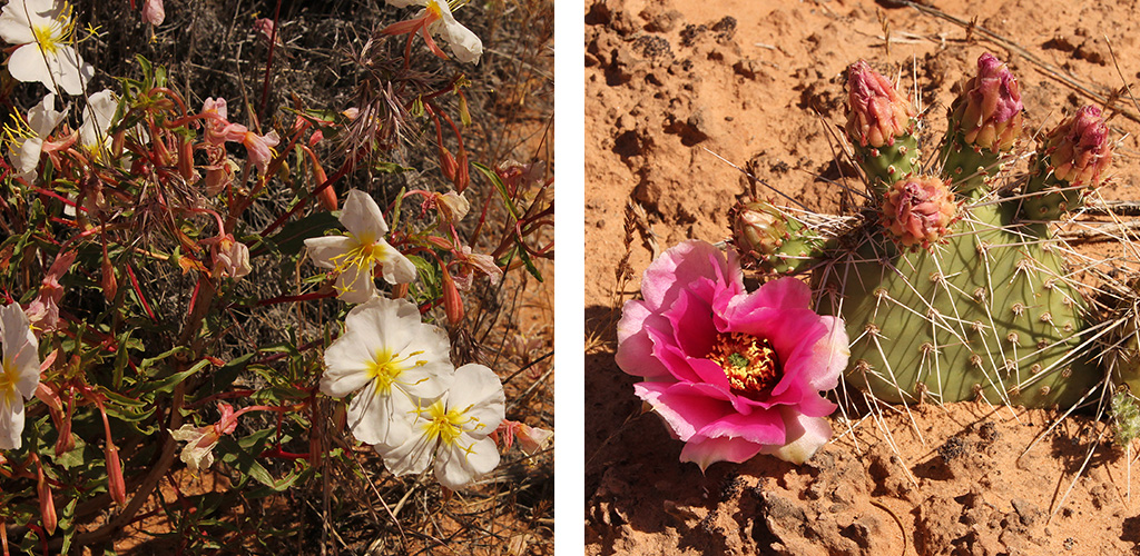
We managed to find a little color among all the red and brown dirt and rocks.
Canyonlands, at 527 square miles, is Utah's largest National Park and it feels like it too.
At this stop, two motorcycle riders drove in just ahead of us, a husband and wife on new matching bikes. Big Bikes. The wife's bike was too big for her and she laid it over trying to park. The husband was NOT happy. Looked like only a few minor scratches.
We had things to do.
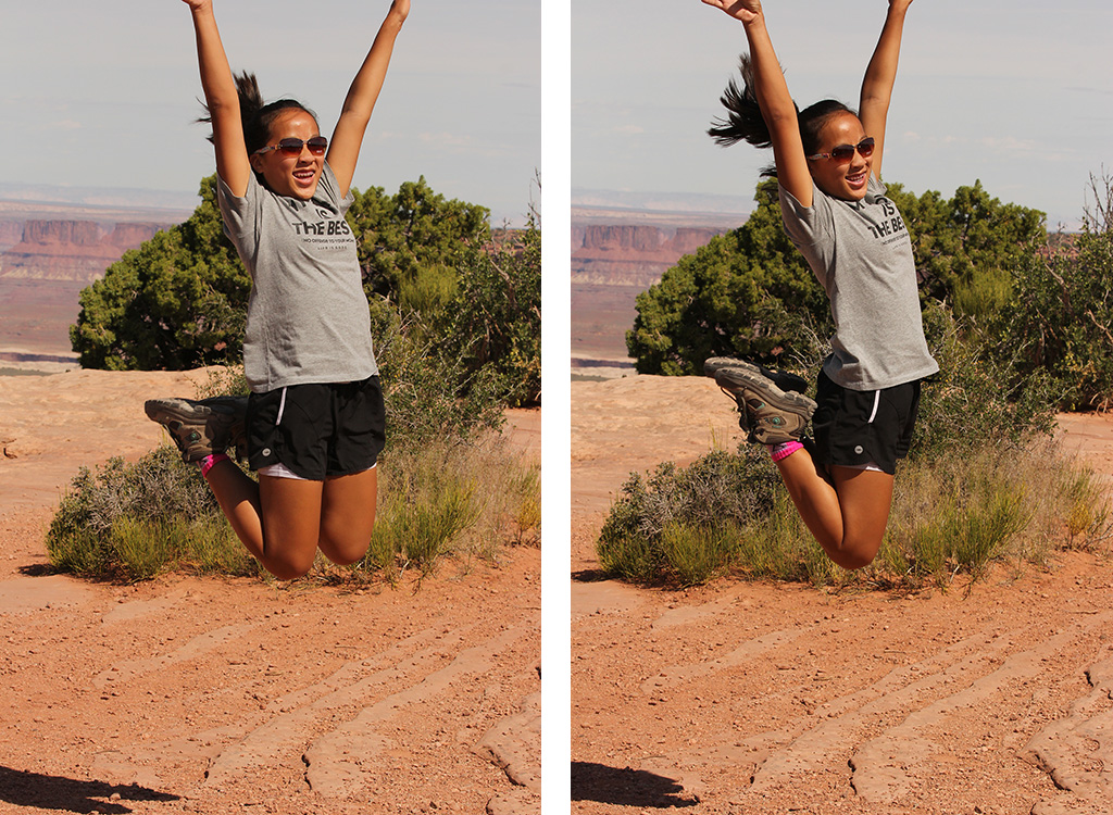
Plus Abby had jumping to do.
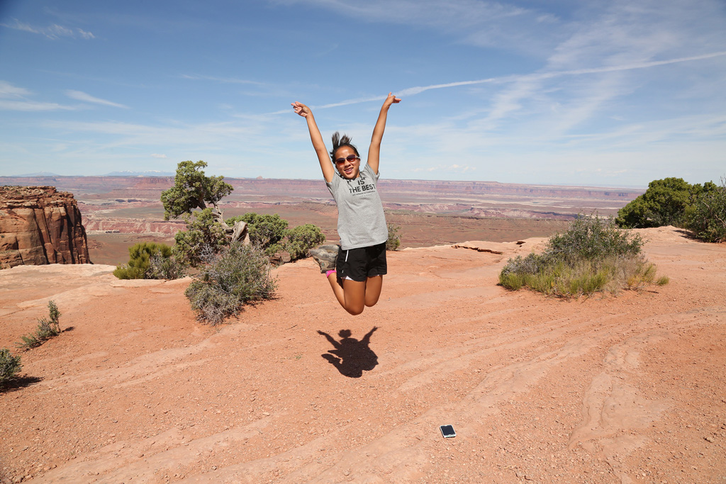
Don't land on your phone!
Next Stop.......
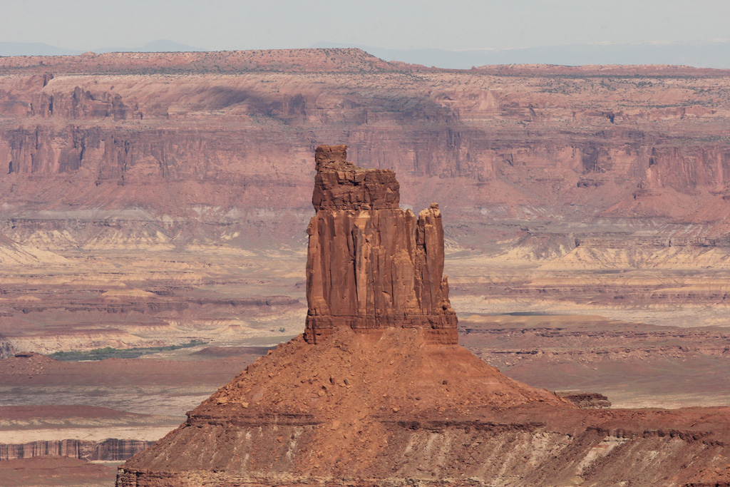
WHITE RIM OVERLOOK & BUCK CANYON
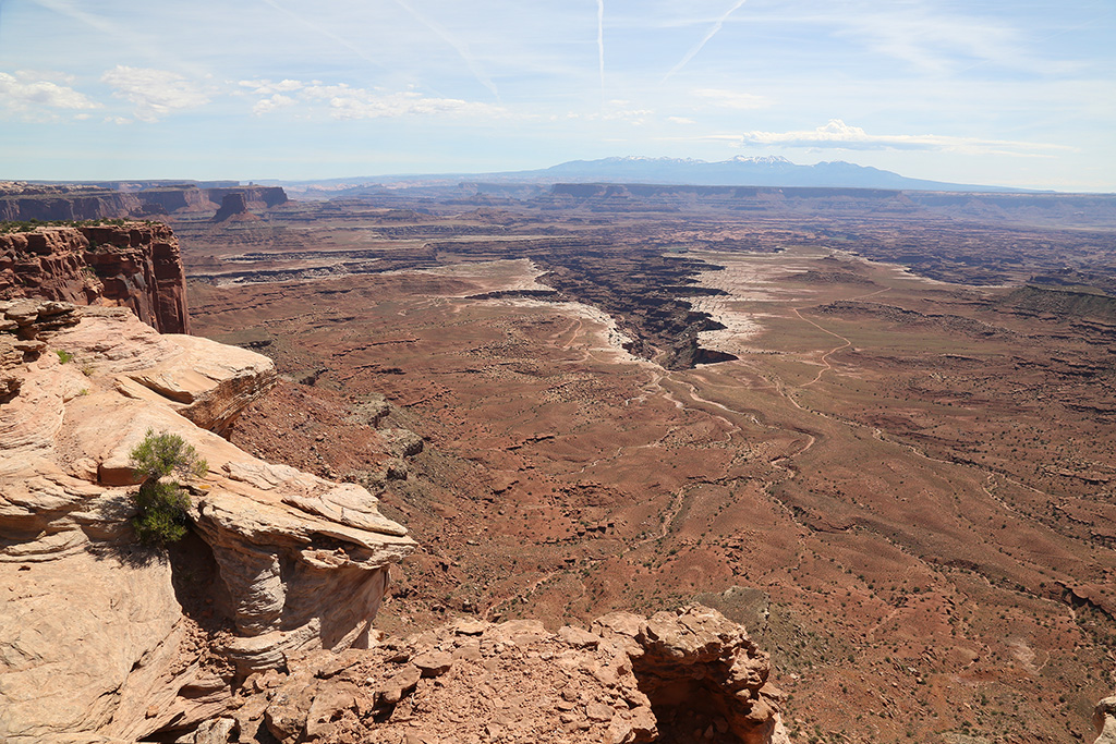
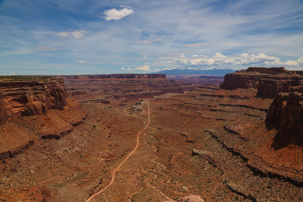
From most of these overlooks, you can see huge cracks in the earth's surface. It really makes one think about how they might have formed.
This overlook faces east and the mountains in the background are La Sal mountains - yes, the same ones we saw from Arches.
I wonder if we can see the Needles District from here?
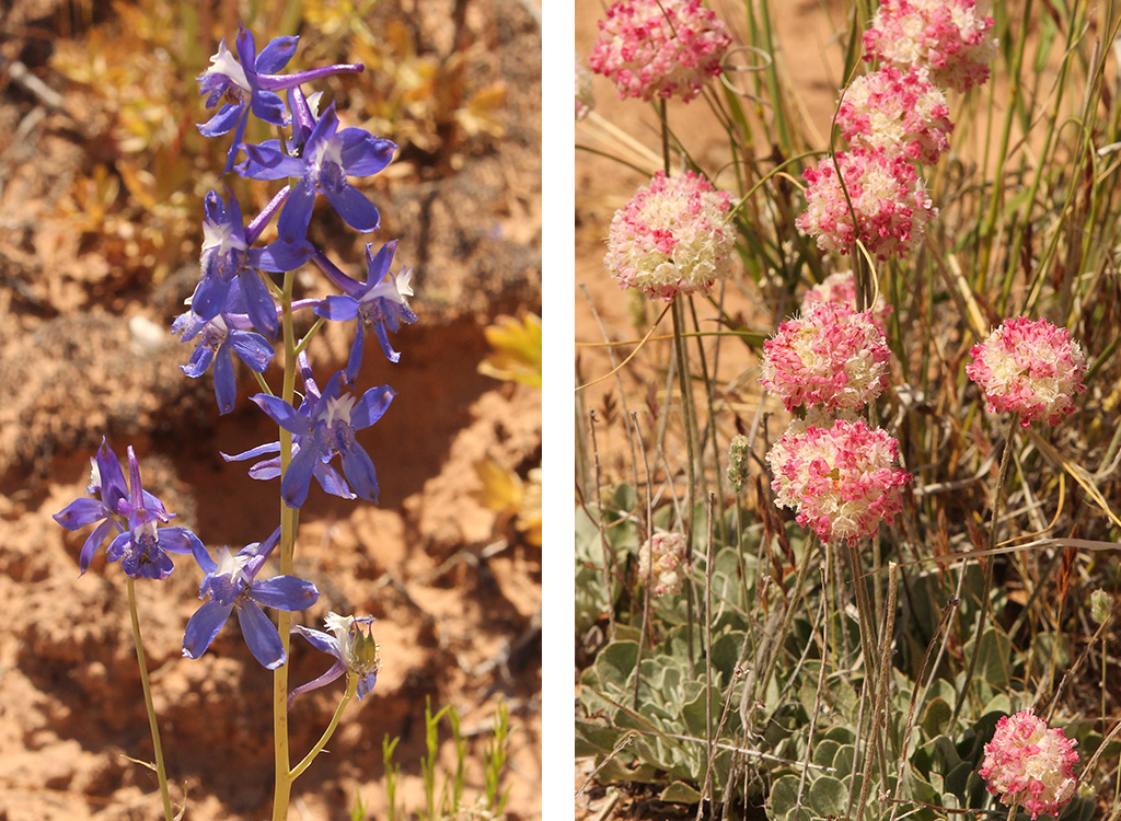
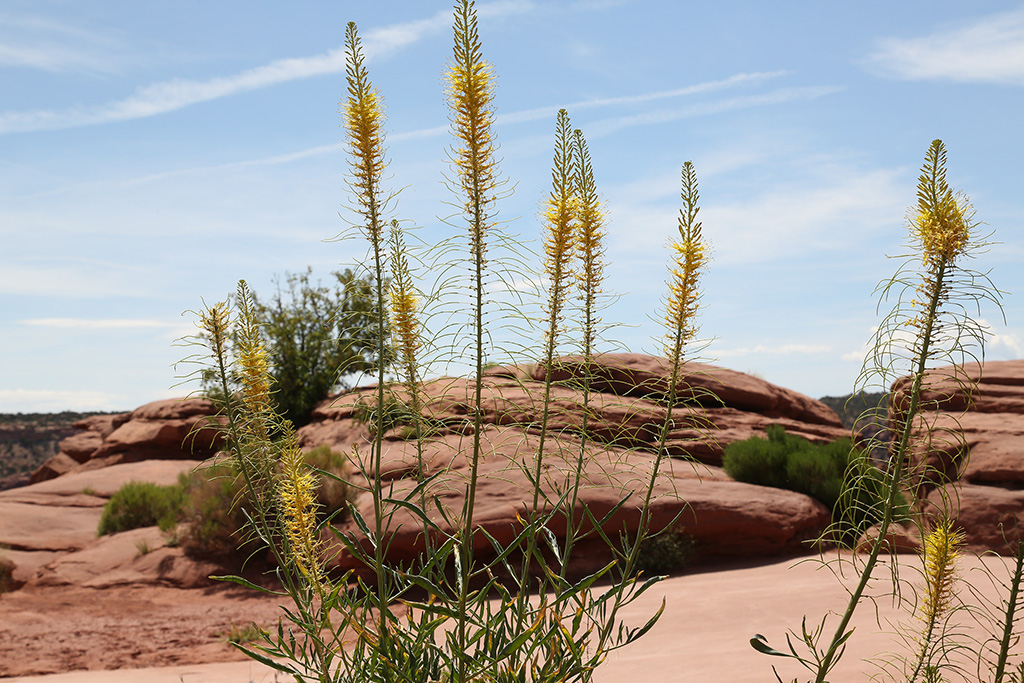
A little color to brighten the trail.
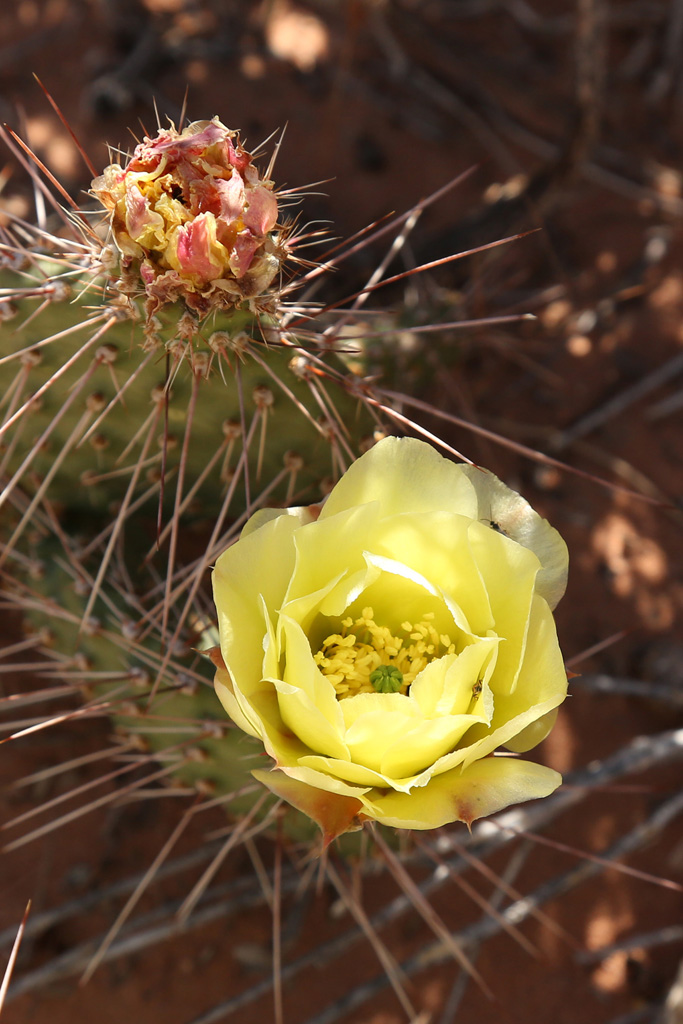
The Buck Canyon area has lots of different types of flowers.
CANDLESTICK OVERLOOK
Looking West
Once again, we are thankful for a gorgeous day. No more coats, gloves, snow, sleet. YAY!
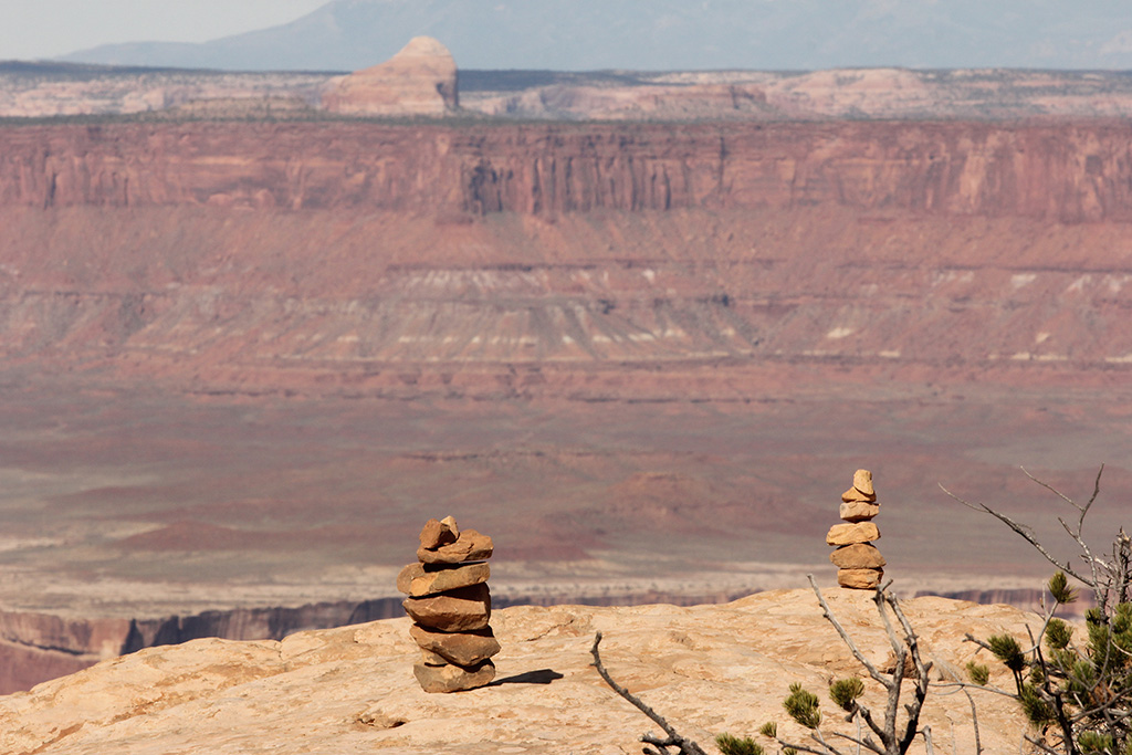
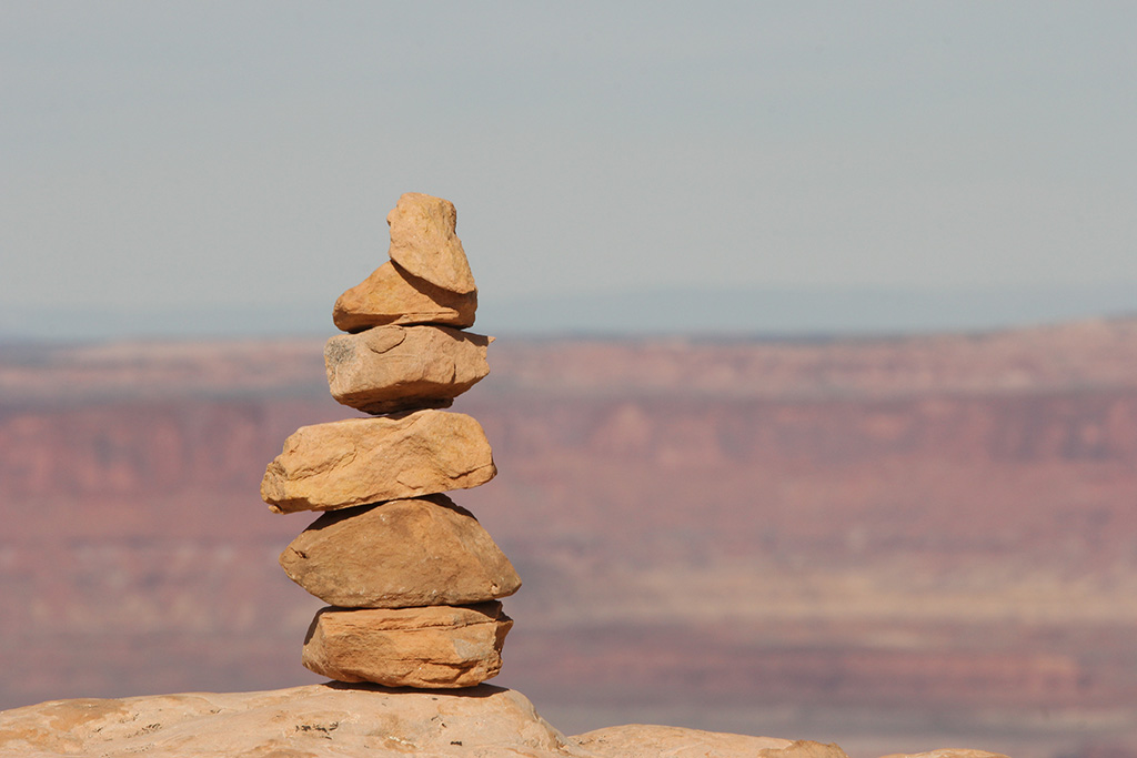
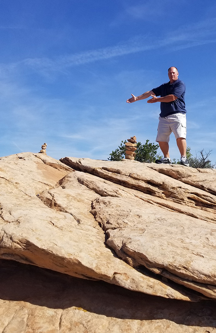
More stacking!
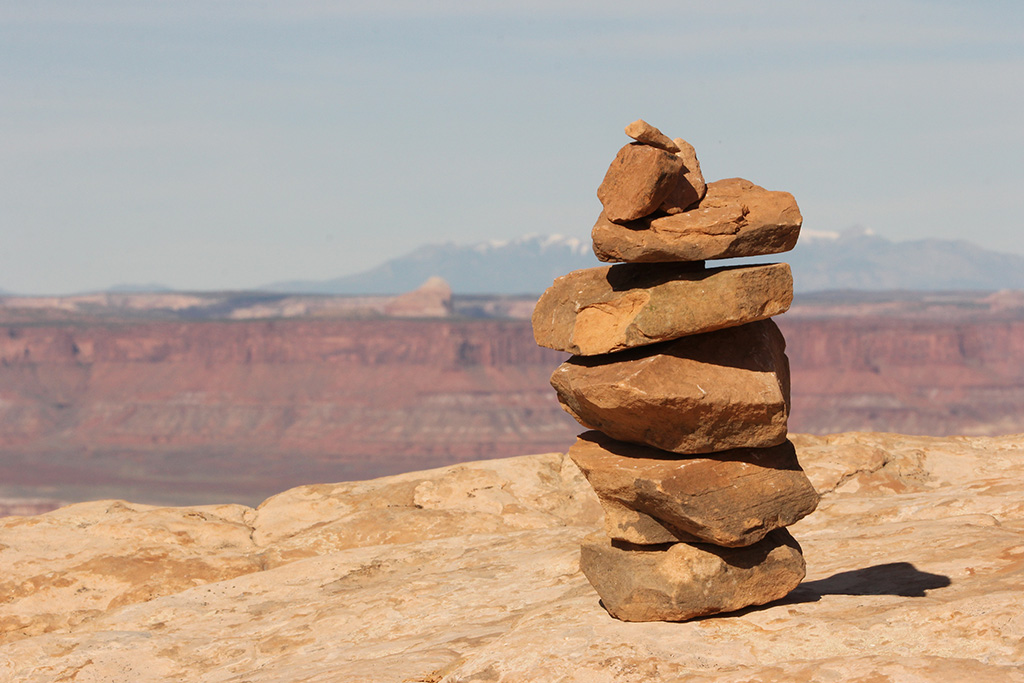
Proud of his creations.
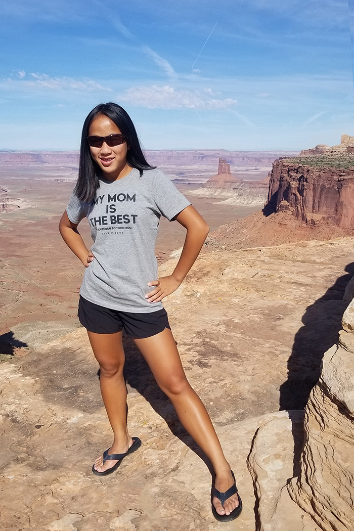
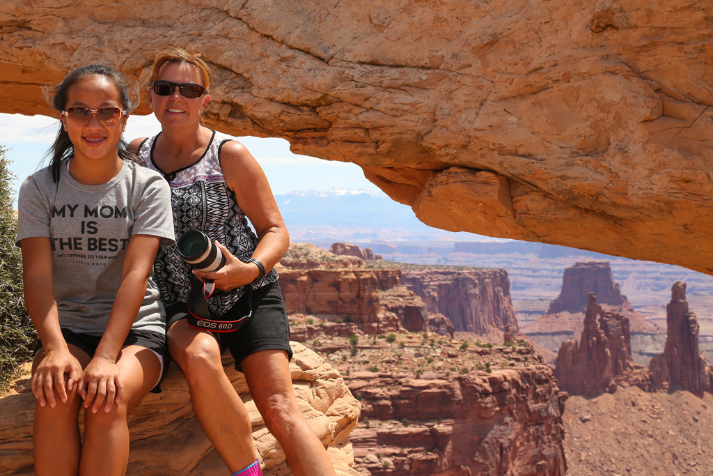
Great shirt! She picked it out herself. It says: MY MOM IS THE BEST No Offense To Your Mom
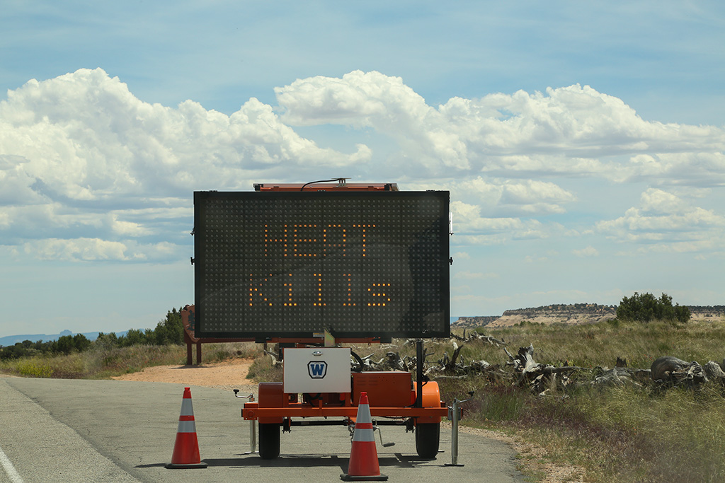
We've been seeing these signs around the parks and have been drinking lots of water.
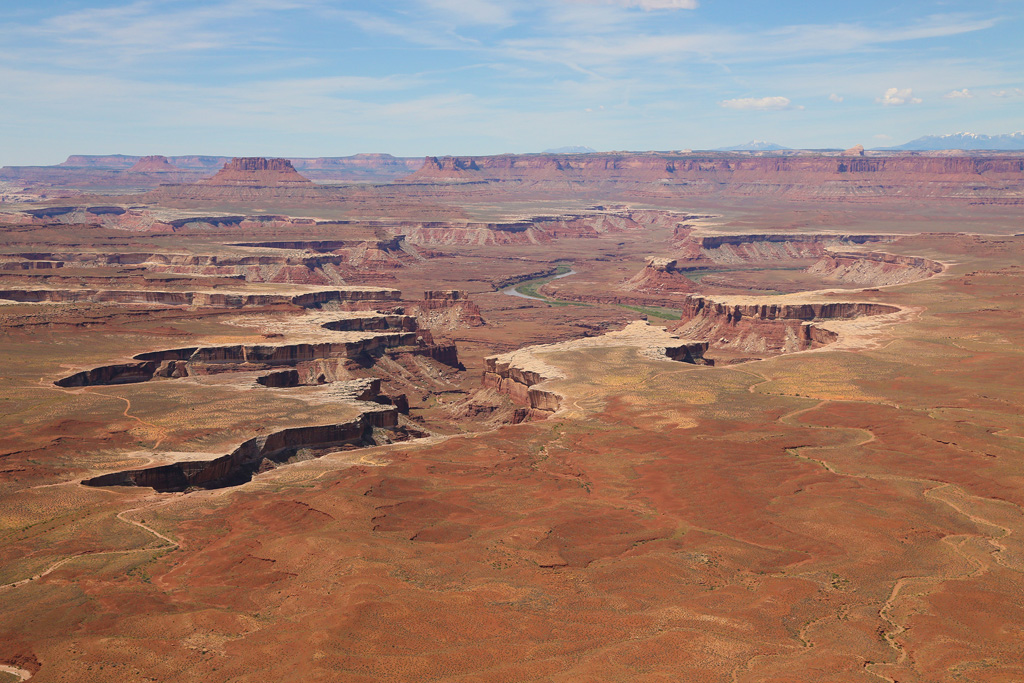
GREEN RIVER OVERLOOK
Another west looking view point.
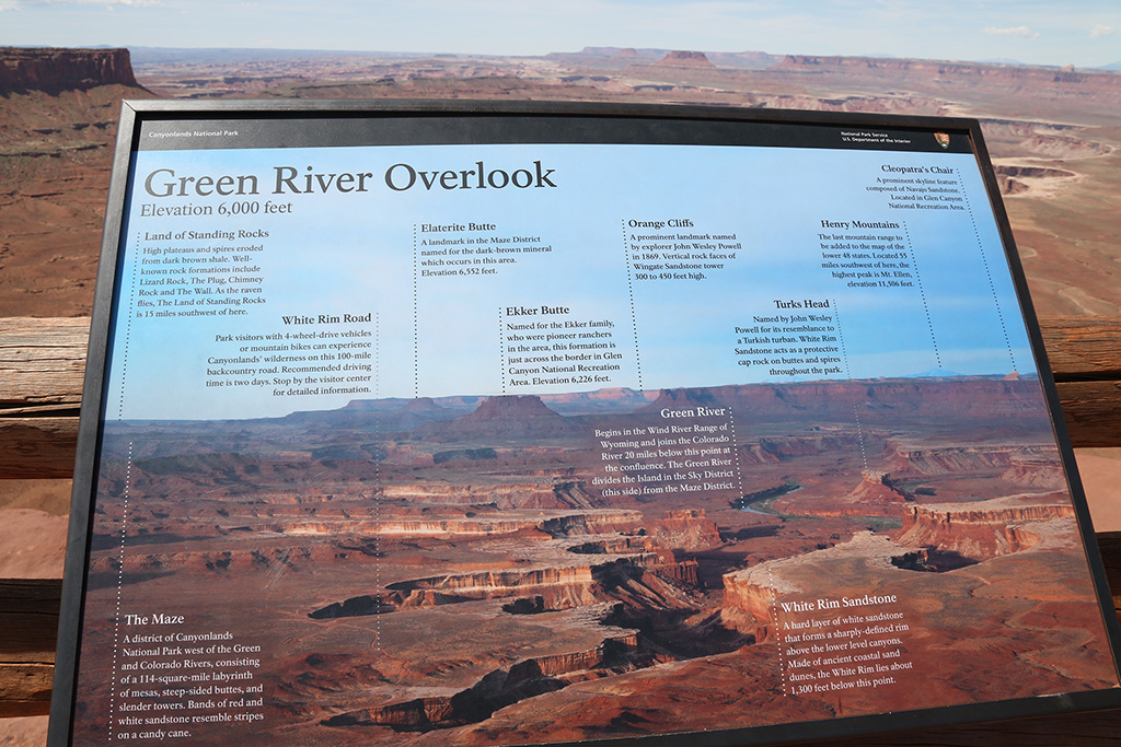
I wished we could have gotten closer to the Green River, but a 100 mile loop dirt road is a long journey - too long for these day hikers and Marriott campers.
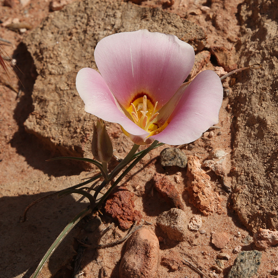
I just liked the yellow flowers.
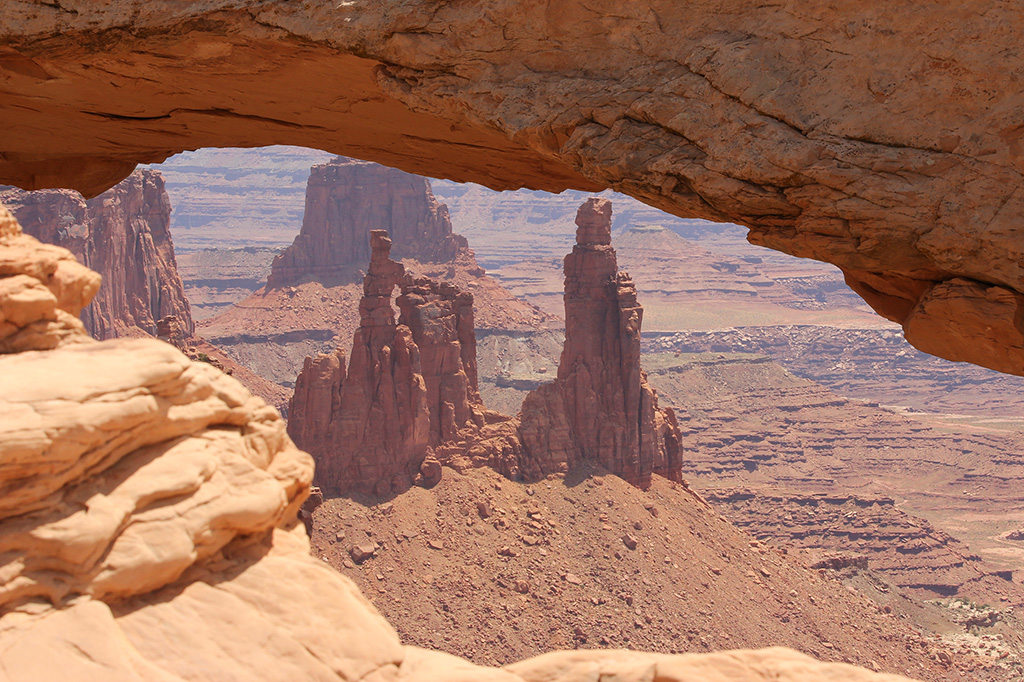
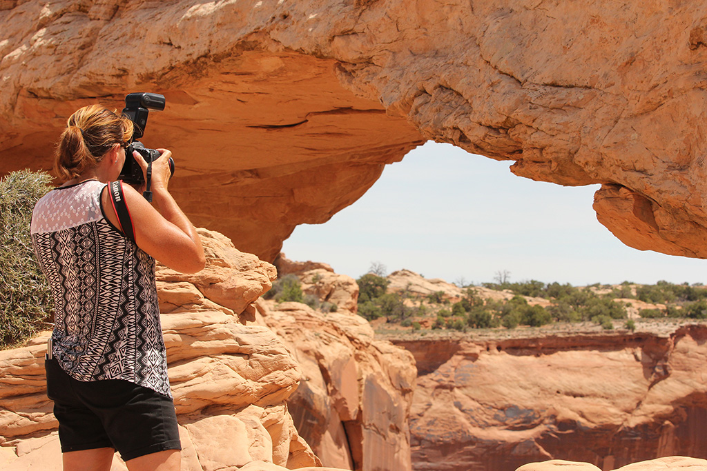
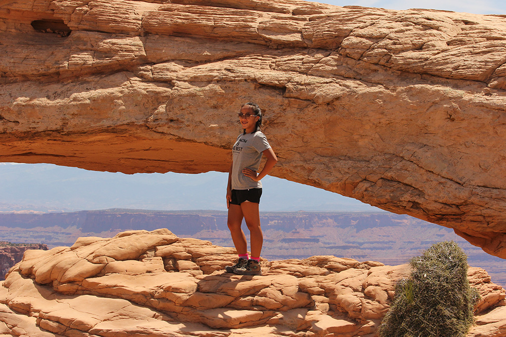
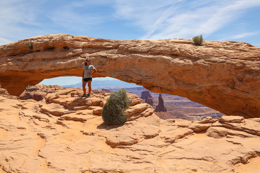
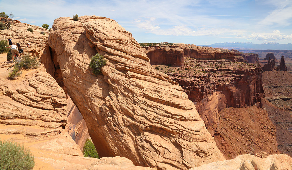
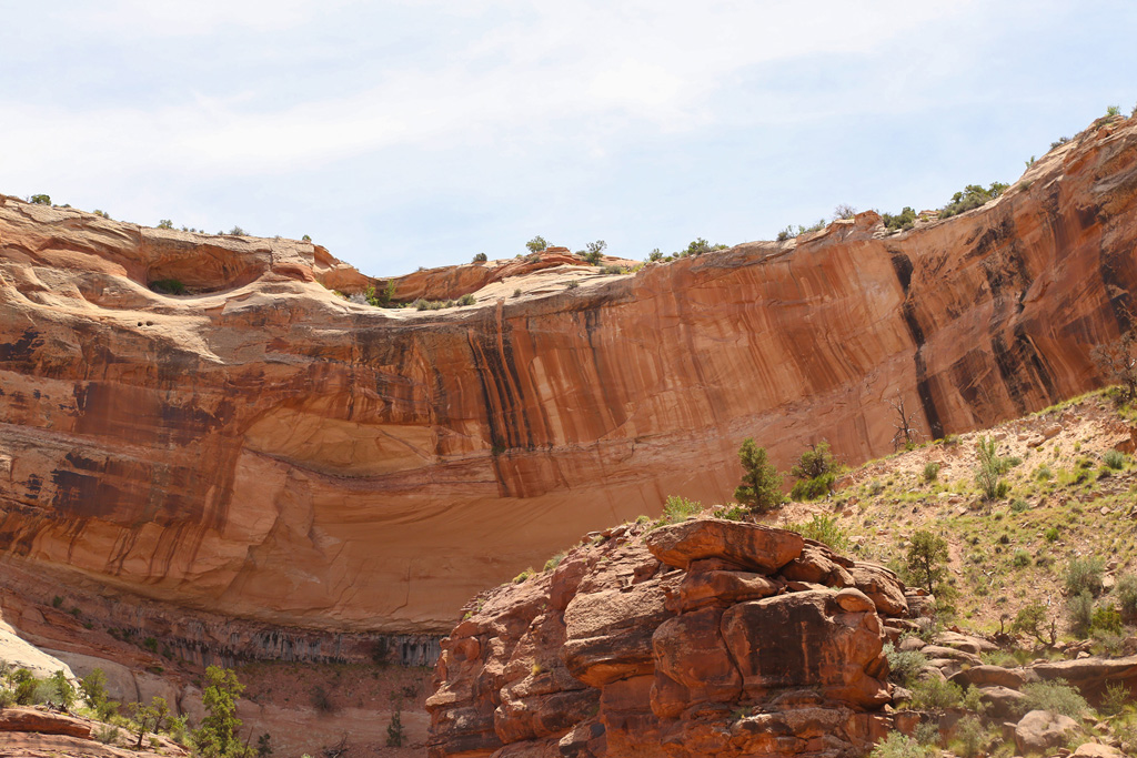
MESA ARCH
Just a short drive from the Green River Overlook, Mesa Arch is a fairly short loop trail, even though it seemed longer because it was pretty hot by now.
Awe, finally it's in view.
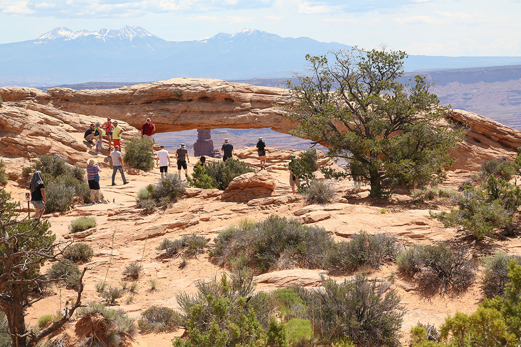
We'll just look through it since there are so many people around.
Me doing what I love.
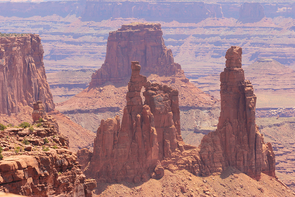
At 500 feet tall, the interesting rock formation in the distance is named Washer Woman and is a known destination for climbing and rappelling.
People are clearing out and taking turns - NICE!
I was able to capture the entire span of the arch without even using pepper spray!
The bush is kind of interesting. I think it looks like a bear.
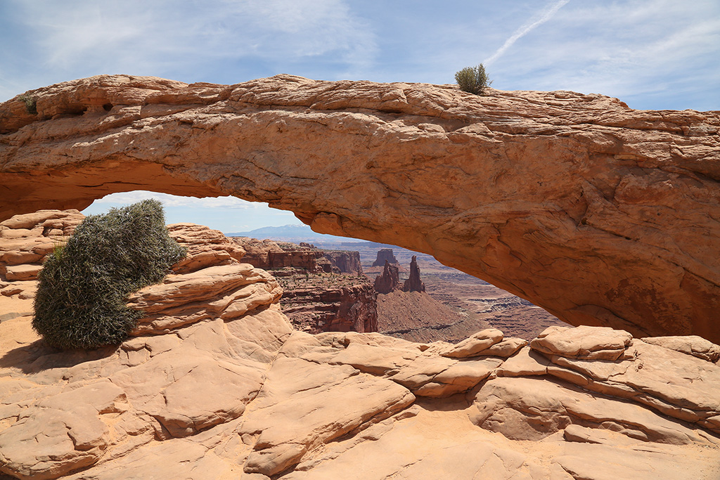
A different view of Mesa Arch which is classified as a pothole arch because it was formed by surface water that pooled on the sandstone behind the arch, slowly eroding the rock. The result is Mesa Arch that spans 50 feet across the mesa’s edge overlooking a 500 foot vertical drop.
Our turn was about up, but we snuck in one more.
We hoped to be here for sunrise, but our hotel was almost an hour away and sunrise was before 6am, so we missed it. The sunrise pictures I've seen are just stunning. Wish I had one. Oh well, this is nice too.
Just to the right of the arch is another scenic Kodak moment.
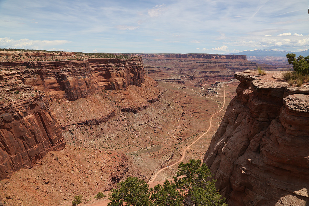
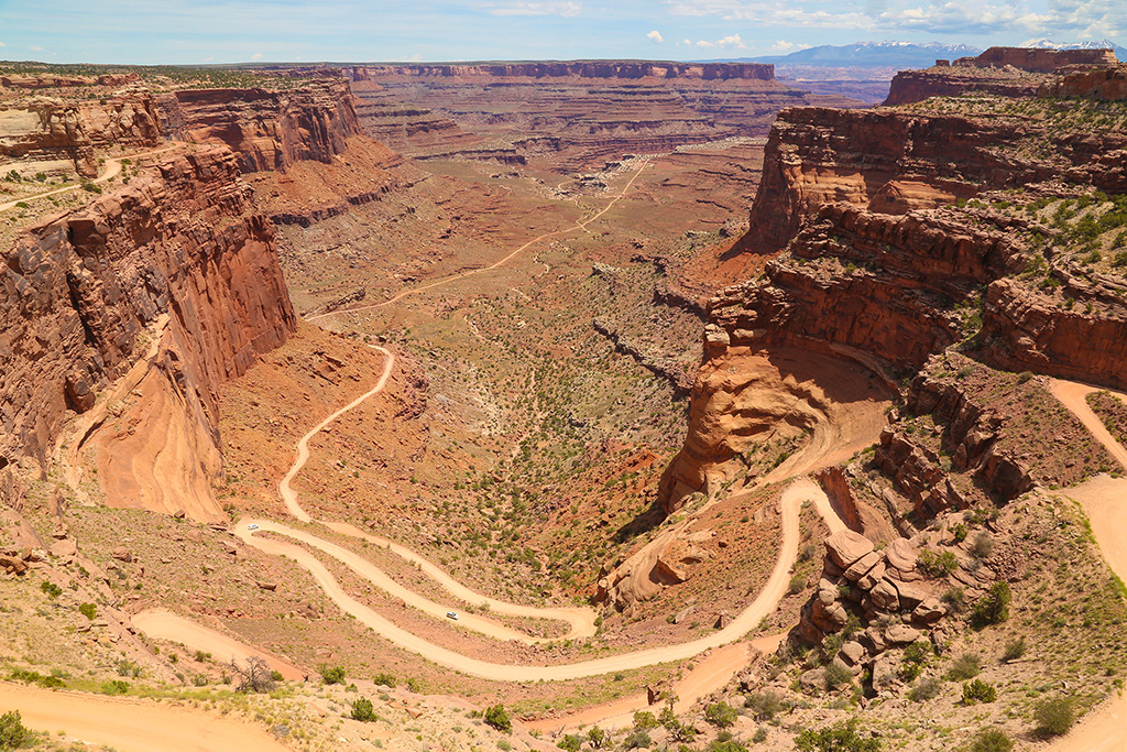
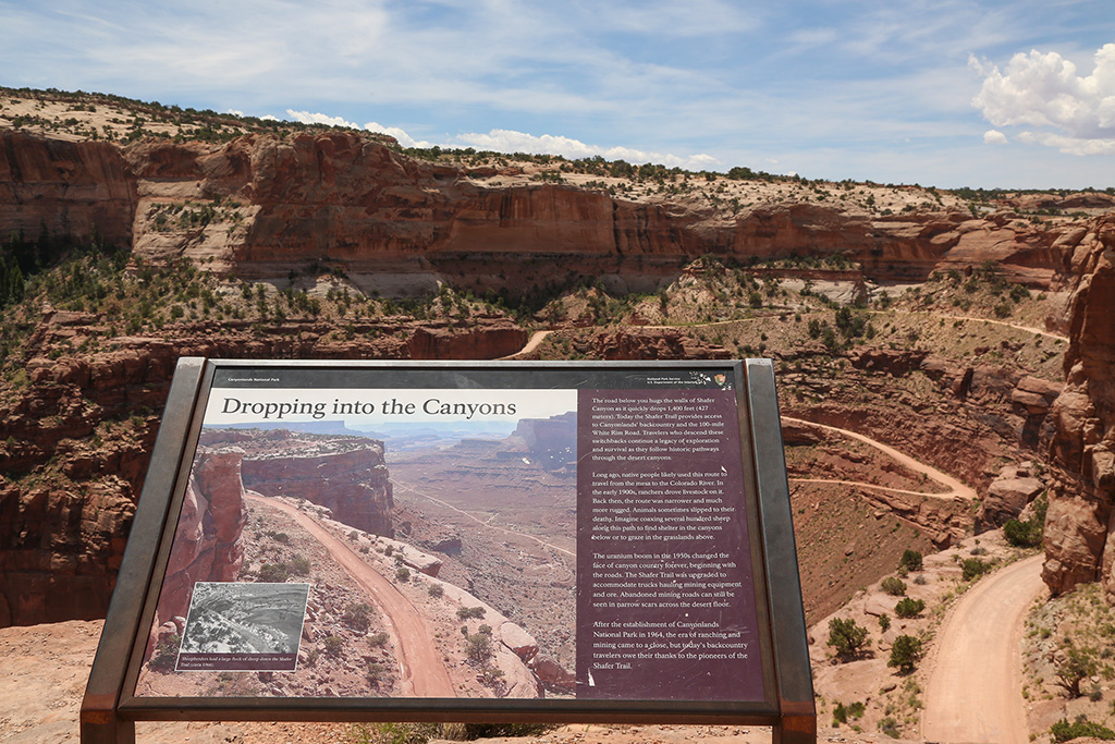
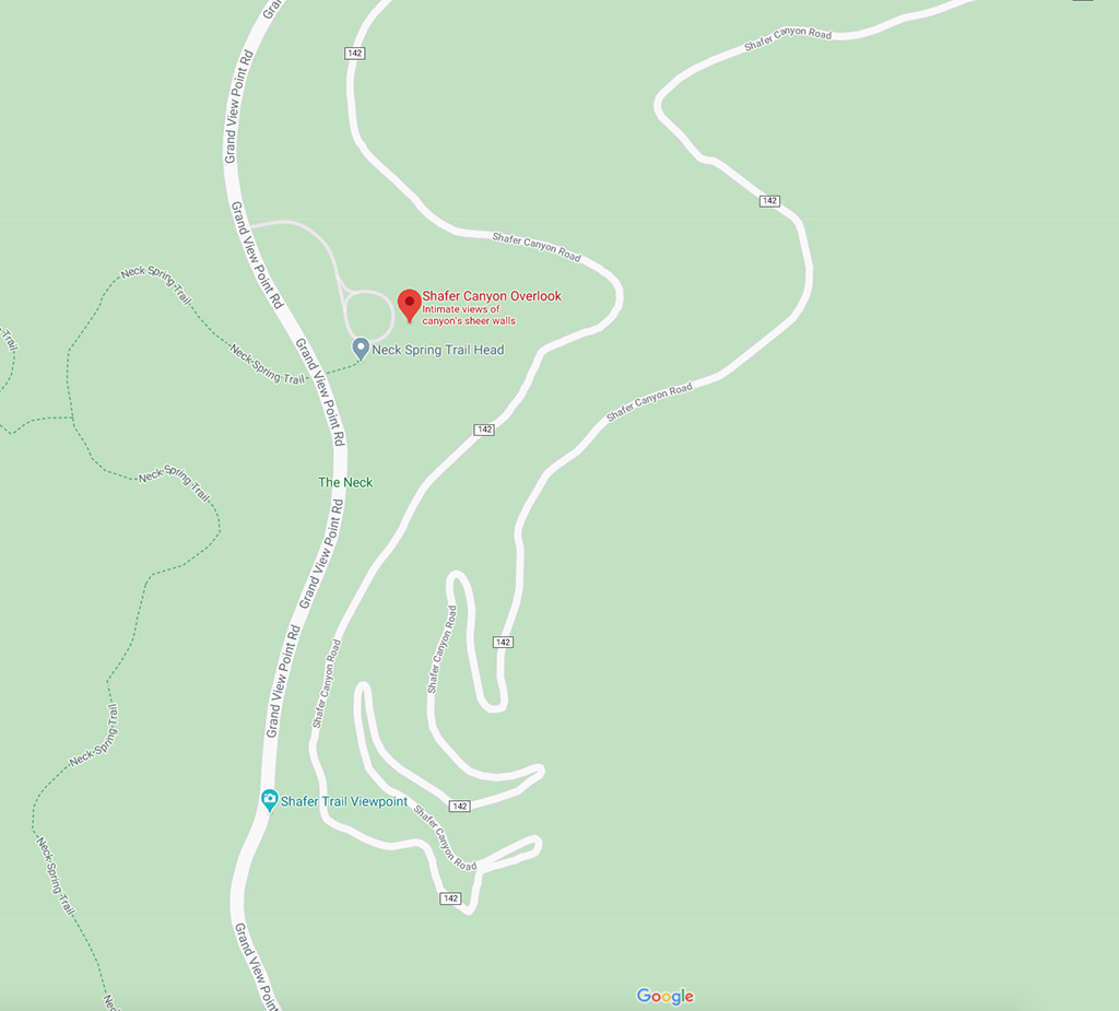
SHAFER CANYON OVERLOOK
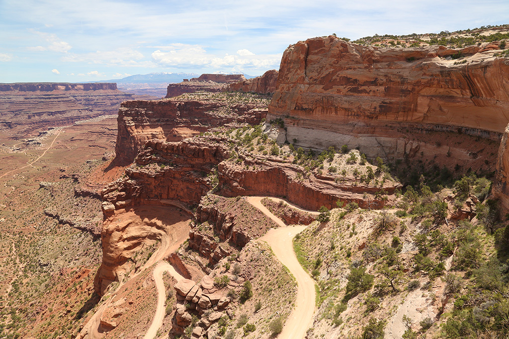
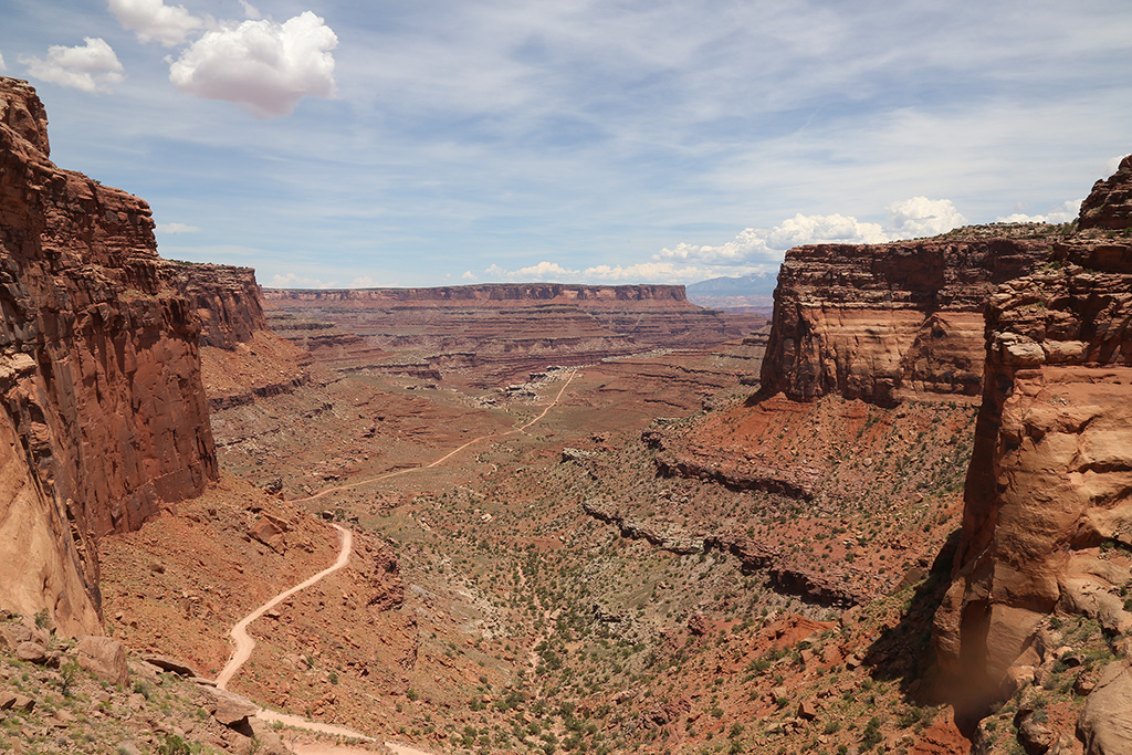
Another short drive to the north, brings us back to the very scenic panoramic viewpoint known as Shafer Canyon Overlook, near the Islands in the Sky Visitor Center.
Walking out we had no idea of what we might see when we reached the end.
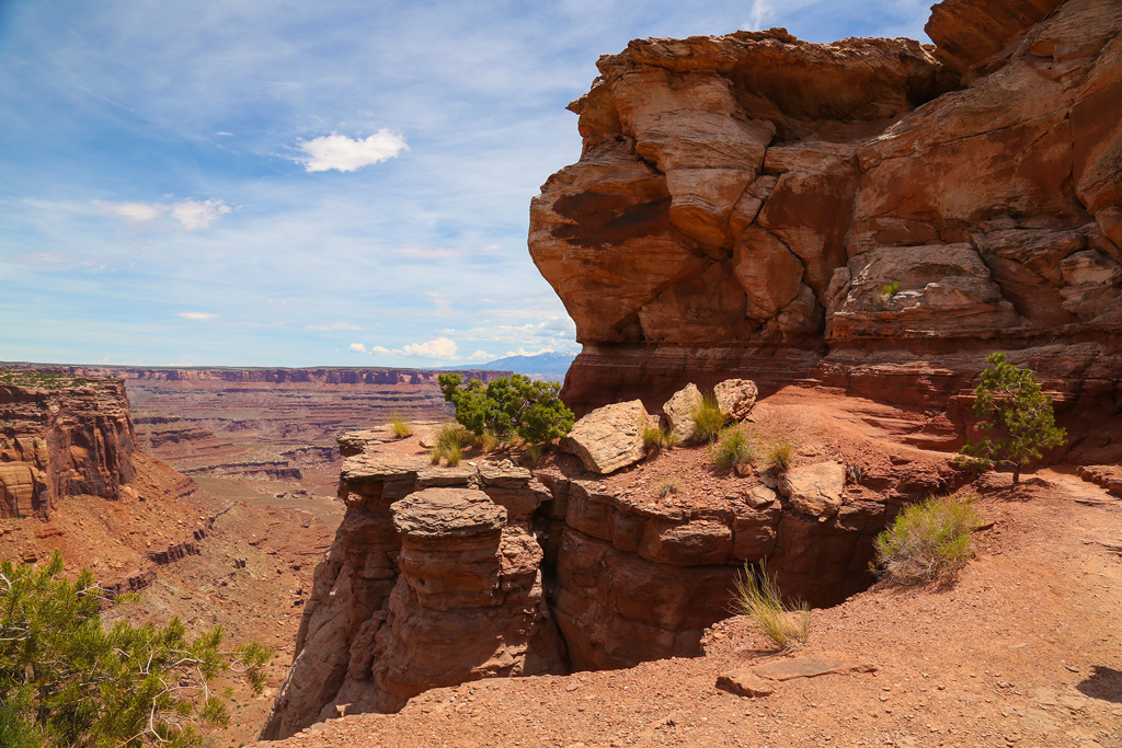
It's really a large plateau that offers an amazing panoramic view into Shafer Canyon. I have no words to describe this beautiful magnificent sight.
We hiked around and through some of the big rocks.
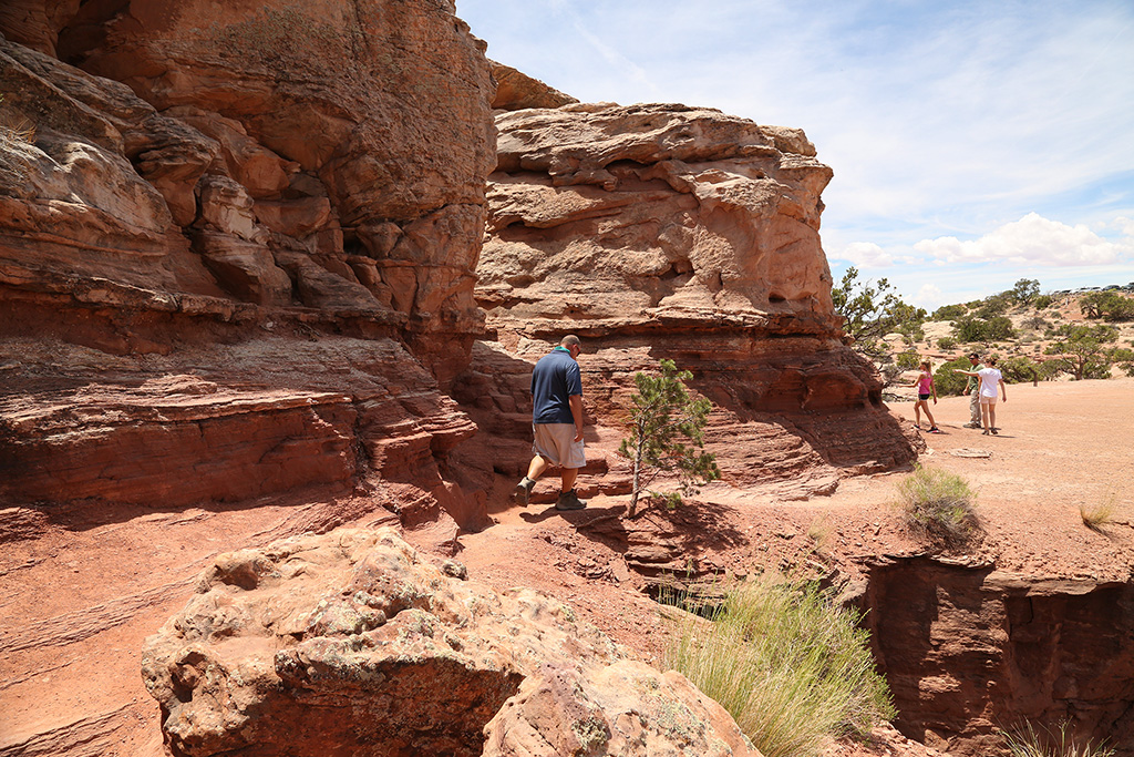
Some of the trails are right at the edge.
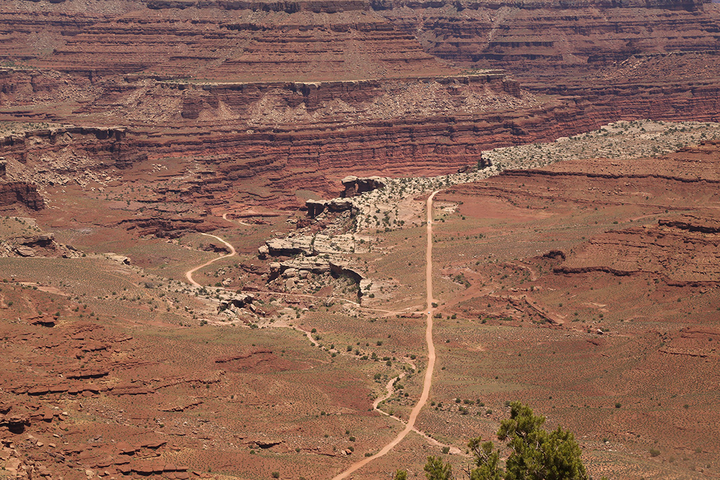
Wonder where this long road goes?
Him from the end of the plateau.
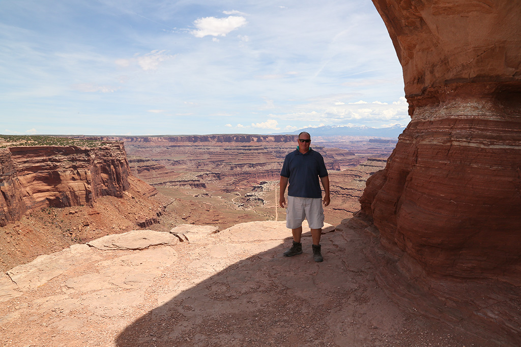
Me from another spot at the end of the plateau.
This old dirt road looks very intriguing and very inviting to me.
Looking toward the south of the plateau.
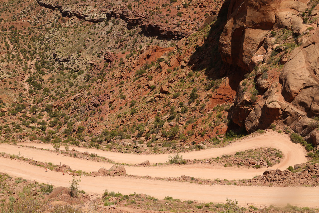
It's a quick, steep 1400 foot descent into Shafer Canyon.
Four wheel drive highly recommended. Lots of switchbacks.
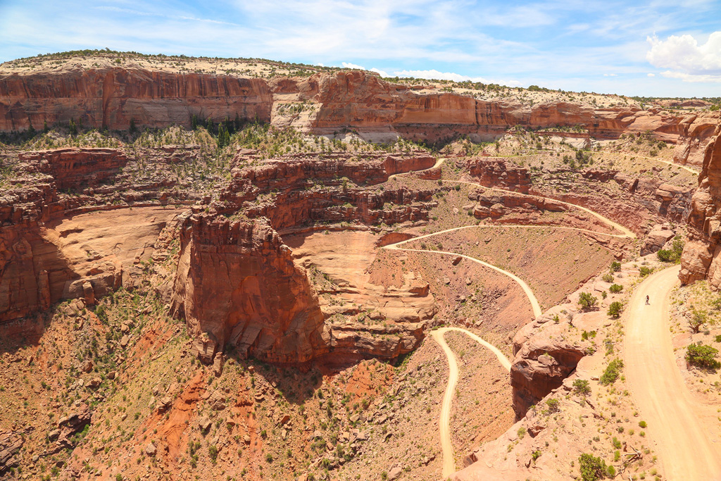
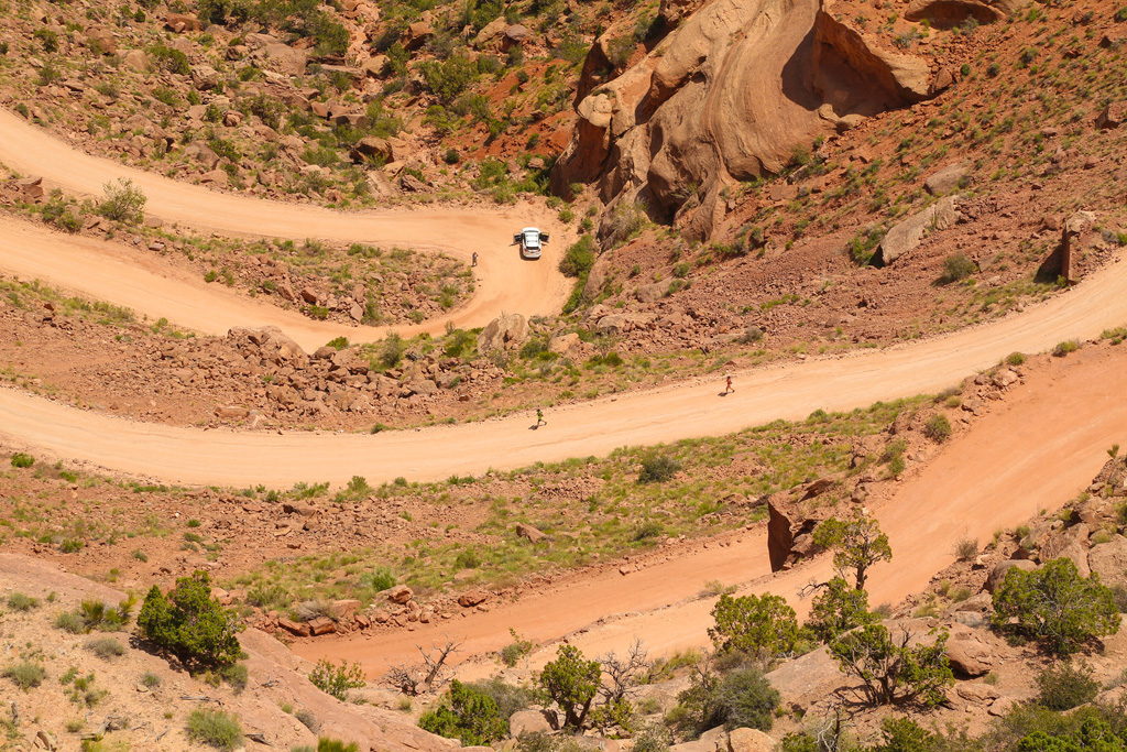
While contemplating whether or not to make the drive, we noticed some runners a few hundred feet below us. Are they crazy? It's HOT here!
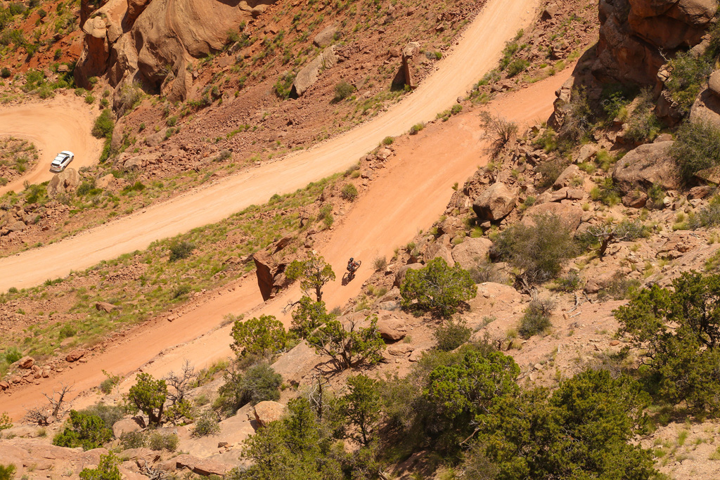
Then we noticed a cyclist!
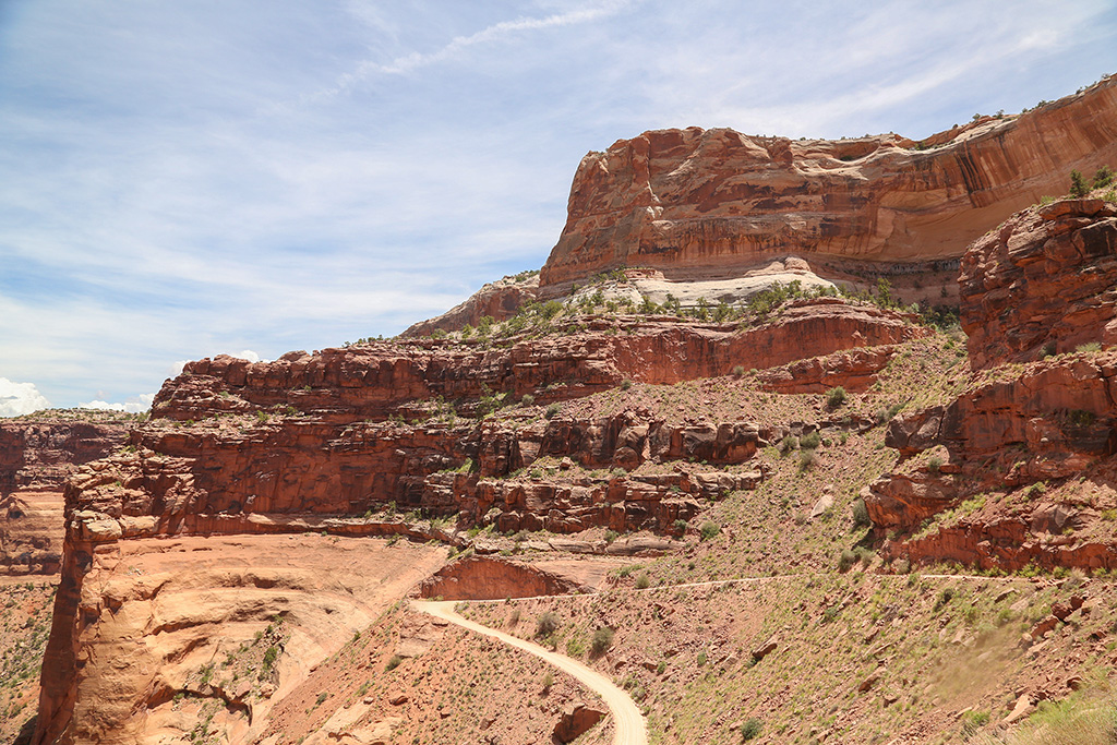
Here we go! We're doing it, driving down Shafer Canyon Road (Rt 142).
It's a very slow and dusty drive.
Once you're over the ledge, the switchbacks look steeper.
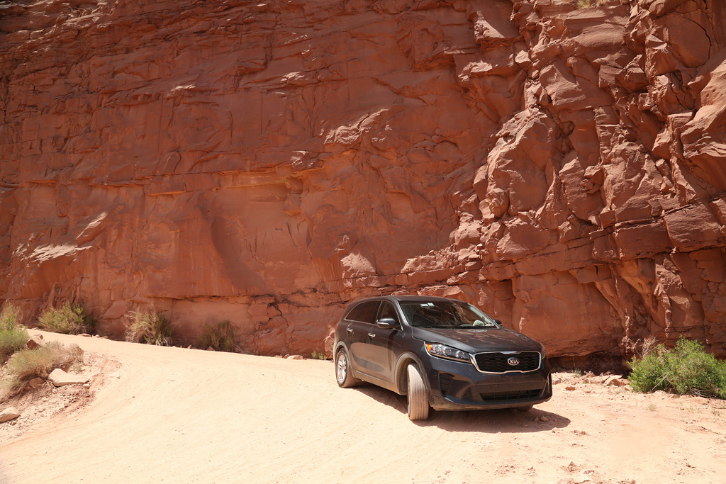
We drove several of the switchbacks and got out of the car several times to take pictures and to look up, back up to the top where we started.
Well, we got what we came for......a twisty drive down the canyon road through the scenic rock formations.
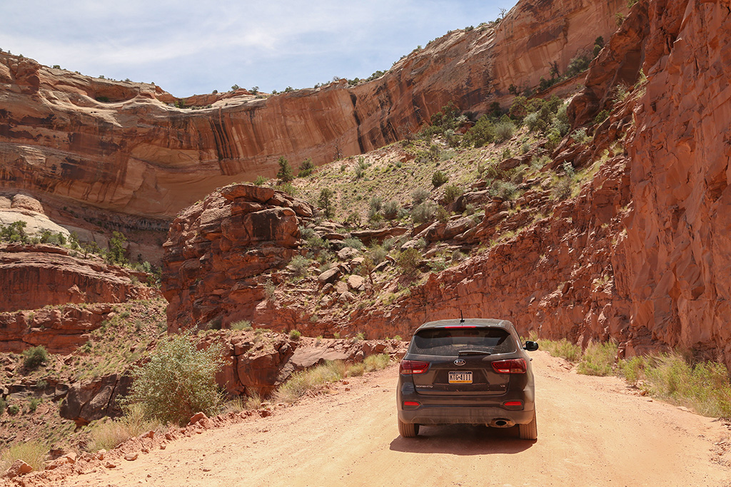
It took us about 30 minutes or more to travel just a few miles so we never intended to travel very far. We could still see the runners way up ahead on the flat road. WOW!
The cyclist was heading back UP the road. I can't even imagine riding a bike up a steep dirt road like this. WOW!
This is one huge slab of rock and the road is just under it. Very cool driving here.
We made it back to the main road with no issues. We usually appreciate an uneventful journey like this.
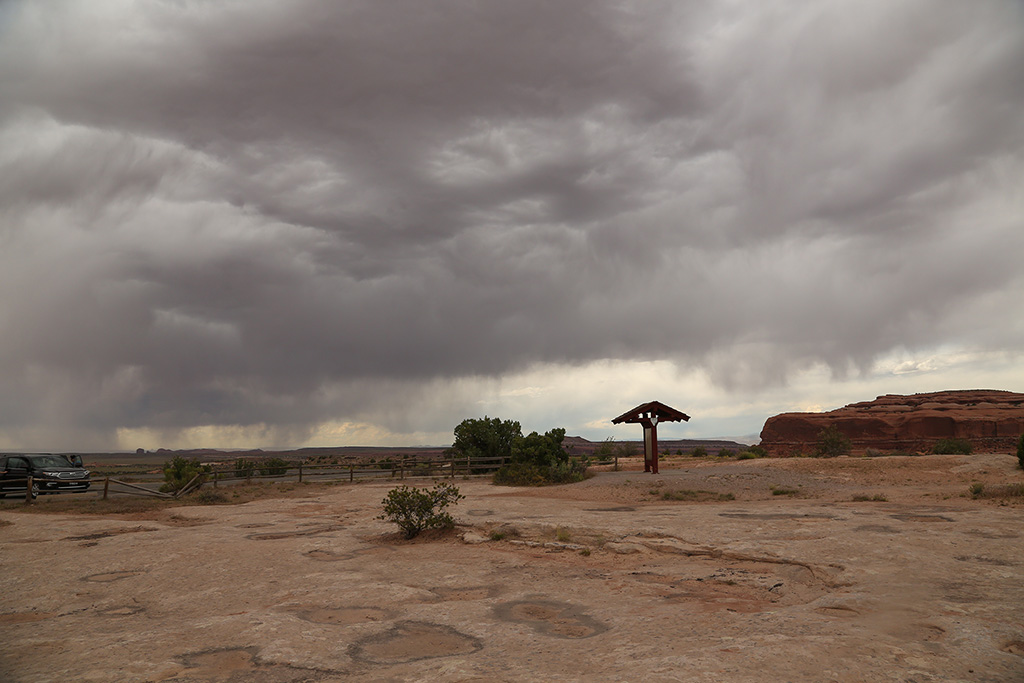
Goodbye Canyonlands - It's been a great day!
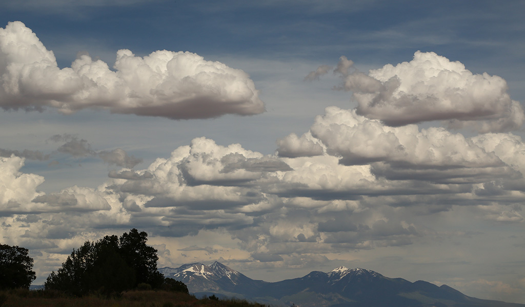
The sky was looking very cool.
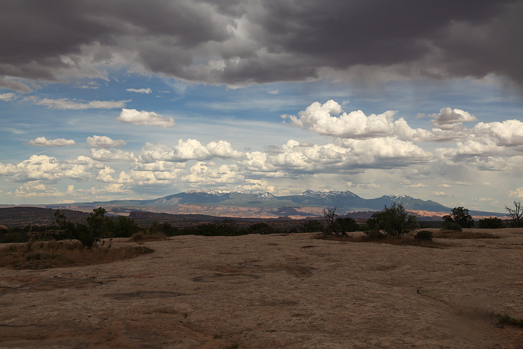
Now with the phone.
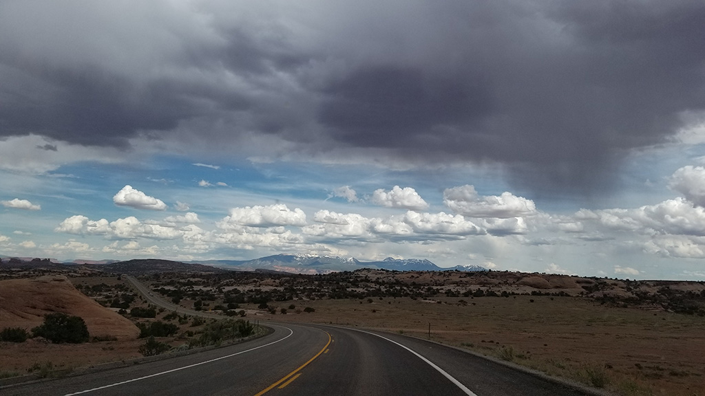
We were spending the night in Hanksville and hoped we could get there before dark and before the rain hits.